Get Photo, Video and Xactimate Documentation of Your Roof for Insurance Claims BEFORE and AFTER the Hurricanes Hit and Damage occurs! Homeowners, Roofing Companies and Insurance Companies can all benefit from Drone Roof Inspections.
0 Comments
(click image to view)  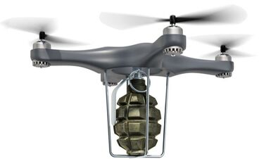 The Federal Aviation Administration (FAA) is warning the general public that it is illegal to operate a drone with a dangerous weapon attached.
Perhaps you’ve seen online photos and videos of drones with attached guns, bombs, fireworks, flamethrowers, and other dangerous items. Do not consider attaching any items such as these to a drone because operating a drone with such an item may result in significant harm to a person and to your bank account. Operating a drone that has a dangerous weapon attached to it is a violation of Section 363 of the 2018 FAA Reauthorization Act enacted Oct. 5, 2018. Operators are subject to civil penalties up to $25,000 for each violation, unless the operator has received specific authorization from the Administrator of the FAA to conduct the operation. “Dangerous Weapon” means any item that is used for, or is readily capable of, causing death or serious bodily injury. Operators should keep in mind that federal regulations and statutes that generally govern drone operations still apply. Some state and federal criminal laws regarding weapons and hazardous materials may also apply to drone operators or manufacturers involved in certain operations. Updated September 9, 2020. Special thanks to Vic Moss for providing updated and more accurate content. Flying Safe and A Brief Overview of the Rules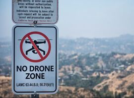 This is a brief overview of safety tips and Federal Aviation Administration (FAA) guidelines for flying an Unmanned Aircraft System (UAS) – often called a drone. We highly encourage you to stay updated with ALL of the current guidelines here: www.faa.gov/uas. Another good resource for staying updated is www.KnowBeforeYouFly.com.
Learn MORE at our LIVE 1 Day Flight Training Class!Langley, Beverly. "Spend Money to Make Money on Listings" Get Listings, Gateless. Retrieved. Bev Langley | $1.5 billion career volume | Severna Park, MD The key to putting on an outstanding listing presentation is putting in the necessary resources to make a presentation pop. Bev Langley understands the value of a good listing presentation, which is why she makes it a top priority. Perhaps Langley’s biggest investment for a listing presentation goes into high-quality photography. Every real estate agent should hire a pro to take photos rather than snap photos on their less impressive smartphones. “The most important thing is photography and it needs to be not from Beverly’s phone, and not from Beverly’s husband’s phone,” Langley said. “It needs to be the best photographer I know of and it needs to be the best system that I can find.” ~ Bev Langley Langley suggests agents spend at least $600 on quality photography and acknowledges that if you don’t put money into photography, you probably won’t last long in the business.
Langley also lists staging, landscaping and property flyers as important qualities to sellers. All agents should be prepared to address each of these needs. “They want to know about staging. I have an in-house staging lady that I use,” Langley said. “They want to know if I’m going to help with landscaping. I have landscaping people that I can recommend. They want to know about flyers and we have a sign with a flyer box. They want to know about brochures and we do a full color brochure.” Langley’s lesson to agents is to always put the necessary resources into the listing presentation. The quality of your presentation could be the difference in the closing price. “If you’re a brand new agent, it’s hard to do. But you have to graduate to that because you really have to spend money to make money.” 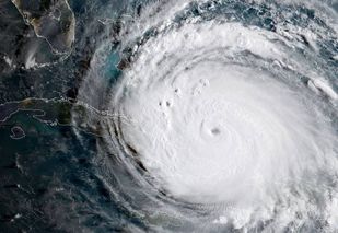 Original Article from: https://www.faa.gov/news/updates/?newsId=88770&cid=TW561
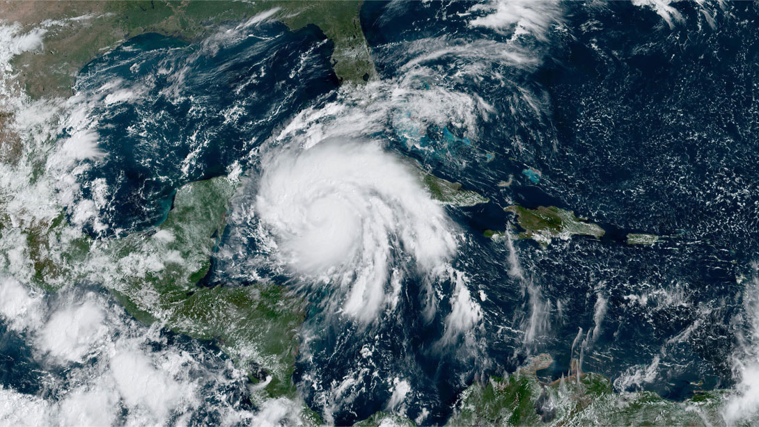
September 15–After the widespread devastation Hurricane Irma wreaked on Florida last weekend, unmanned aircraft – more popularly, drones – have been invaluable in supporting response and recovery efforts in the battered Sunshine State. When Irma’s winds and floodwaters damaged homes, businesses, roadways and industries, a wide variety of agencies sought Federal Aviation Administration authorization to fly drones in the affected areas. The FAA responded quickly, issuing a total of 132 airspace authorizations as of today to ensure the drones can operate safely. For example, the Air National Guard used drones normally tasked for combat operations to perform aerial surveys. The drones allow the Guard to assess disaster-stricken areas quickly and decide which are the most in need of assistance. Similarly, U.S. Customs and Border Protection sent drones from Corpus Christi to Florida to help map areas in Key West, Miami and Jacksonville, using radar to survey geographic points on infrastructure such as power plants for The Federal Emergency Management Agency. The private sector is playing its part as well. For instance, Airbus Aerial, the commercial drone services division of Airbus, is helping insurance companies act more quickly on claims coming in from homeowners. The company is combining data from drones, manned aircraft and satellite data to give a clearer overall image of specific locations before and after an incident. Irma left approximately 6 million Floridians without electric power as temperatures remained in the mid-80s, so bringing the power grid back up is critical. In the northern part of the state, Jacksonville Electric Authority (JEA) is using drones to assist not only with power restoration, but also to ensure the safety of its crews. JEA said it was able to get all its damage assessments done within 24 hours after the storm passed through. Drones also have played a significant role in helping Florida Power and Light (FPL) restore electricity – especially air conditioning – for its 4.4 million customers. The company has 49 drone teams out surveying parts of the state still not accessible by vehicles. Some of the drone operators FPL hired were flying within an hour after the storm winds subsided. FPL cited the recovery effort as a stellar example of cooperation by local, state and federal authorities, including kudos for the FAA. The search and recovery effort in Florida followed all too soon on the heels of similar operations in the Houston area, where drones played a vital role as well. The FAA issued 137 authorizations, sometimes within a few hours, to drone operators performing search and rescue missions and assessing damage to roads, bridges and other critical infrastructure. In addition to the direct response and recovery efforts, several media outlets flew drones over Houston to provide coverage to local residents and the world about flooding and damage in the area. The FAA’s ability to quickly authorize unmanned aircraft operations after both Irma and Harvey was especially critical because most local airports were either closed or dedicated to emergency relief flights, and the fuel supply was low. FAA Administrator Michael Huerta neatly summed up the importance of drone operations to Irma and Harvey recovery operations in a speech to the InterDrone conference last week: “Essentially, every drone that flew meant that a traditional aircraft was not putting an additional strain on an already fragile system. I don’t think it’s an exaggeration to say that the hurricane response will be looked back upon as a landmark in the evolution of drone usage in this country.” The FAA is also helping with another key part of the Irma recovery by moving a second mobile air traffic tower from Connecticut to Key West, FL to provide a safe, sheltered environment for air traffic controllers to manage relief traffic at the airport. Earlier this week, the FAA shipped another mobile tower to storm-battered St. Thomas by air to support controllers there. The tower for Key West is scheduled to leave Connecticut today on a truck and arrive in Key West in the next few days. Original Article from: https://www.faa.gov/news/updates/?newsId=88770&cid=TW561  AERIALS Proven To Sell FASTER And on Average For More Money
Now that more and more real estate agents have access to aerial photos and videos through drones, homebuyers and sellers are changing the way they expect to interact with real estate listings. According to MLS statistics, homes with aerial images sold 68% faster than homes with standard images. Video tours that incorporate drone footage are also a great way to make your property stand out and to attract new listings. According to the National Association of REALTORS® (NAR), 73% of homeowners say that they are more likely to list with a real estate agent who uses video to market their home; however, only 9% of agents create listing videos. An Australian real estate group reported seeing a 403% increase in traffic for listings that included video as compared to listings without."
Why do you need a slideshow if you request a video?
Answer: for video to appear on MLS it needs to appear in one movie file. To accomplish this we create a slideshow out of your MLS photos and then incorporate video into it. The completed movie file often consists of 3 or 4 video clips. Typically an introduction with aerial footage flying in the front door of the house, an outro of aerial footage flying away from the house and additional clips featuring unique features of the house. Below is a very good example of a slideshow with video clips:
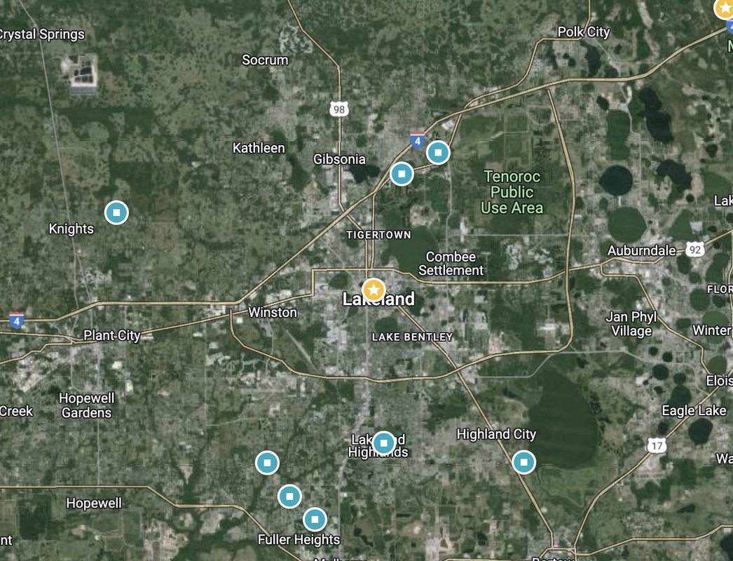
This movie consists of 3 video clips and a slideshow: Video clip #1 is aerial footage of Lake Hollingsworth in Lakeland, FL. It transitions into the slideshow at the 23 second mark. Video clip #2 begins at the 1:43 mark and circles around the house showcasing the carport and oversized lot. Video clip #3 begins at the 2:05 mark with an aerial video flying away from the home and back over Lake Hollingsworth.
MLS Video Walk-through Example:MLS Slideshow Example: |
Categories
All
Archives
May 2023
|
 RSS Feed
Drone Elevations is located at 502 East Main Street, Lakeland, FL 33801.
|
Mon-Fri: 9:00a-5:00p (Check Availability)
|
Sat, Sun & Holidays: Limited Availability
|
|
|
Vertical Divider
|
|
Drone Elevations is affiliated with the following organizations:


Please note: waivers and authorization might be required due to FAA airspace restrictions.
All pricing and special offers are due to change without notice. travel fees could apply.
Registered with the FAA. All Pilots are Part 107 Certified. Licensed and Insured (General Liability for both ground and aerial). Preferred Business Partner of LAR. Member, Trained and Certified by Sky Eye Network the world's largest network of drone entrepreneurs. Proud member of PPA, DJI and AMA.
We adhere to the CDC Covid recommendations.
We adhere to the CDC Covid recommendations.
Copyright © 2016-2024 Drone Elevations, LLC | Privacy Policy | Terms & Conditions | Site by NOVAK Brand.
Home | Services | Examples | Testimonials | FAQ | News & INFO | CONTACT | SITEMAP

x
We are open thanksgiving FOR real estate photoshoots.
Please Note: A minimum $45 Holiday Fee applies for jobs captured on 11/24 and 11/25.